The counter-drone threat and policy picture, sourced and kept current.
The C-UAS Portal brings together what drones are doing, what the law allows, and the planning and reporting work that sites and agencies have to do. Every record is reviewed by an analyst and linked to its source.
- 29,000+
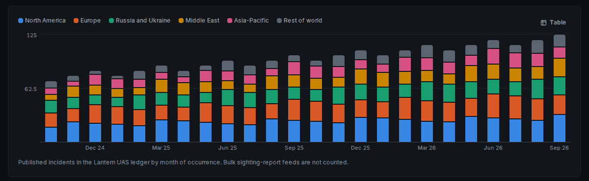
- drone incidents worldwide, each reviewed and linked to its source
- 1,500+
- laws, rules and programs tracked in the U.S. and Europe
- 14,500+
- threat profiles: drones, capabilities and the actors behind the incidents
- 11
- jurisdictions with counter-drone authority mapped, cited to the law
- 540+
- counter-drone procurement opportunities tracked
Figures as of November 2026.
The picture
Worldwide incidents
Airport disruptions, prison contraband, incursions over critical sites and events, and drones in conflict. Each record is checked against its sources, classified and placed on the map.
Platforms and tactics
The drones, capabilities and tactics behind the incidents, and the actors using them, linked back to the incidents where they appear.
Law and authorities
U.S. and European counter-drone legislation, rules and guidance from proposal to enactment, and who may detect, track and act against drones in each jurisdiction, cited to the law.
Airspace
Airspace restrictions over and around the sites that matter, shown with the incidents and authorities that apply there.
Process support for sites and agencies
Knowing the picture is the start. The portal also supports the work that follows.
Coverage planning
Lay out sensors around a site, see where they overlap and where they leave gaps, and test the plan against simulated flights.
Pattern of life
Understand normal drone activity around a site so the unusual stands out.
SAFER SKIES workflows
Support for state and local agencies working under the SAFER SKIES Act.
Reports
Exports and reports for leadership, partners and after-action review.
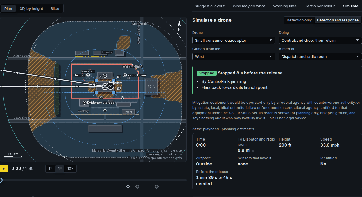
Policy summaries in the portal are informational, not legal advice. Planning estimates are for planning only and say nothing about who may lawfully act.
The C-UAS Portal is coming soon.
Join the early access list and we will tell you when it opens.